Written by: Carlyn Scott, Communications Manager
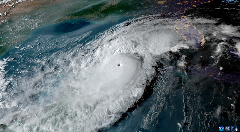
Just ten days after Hurricane Helene brought storm surge to much of Florida’s west coast, a different low-pressure system began brewing in the southwestern Gulf of Mexico. A few hours after its development on Saturday, October 5, the National Hurricane Center (NHC) declared it a tropical storm. By the next day, it was named Milton, and rapidly intensified into a Category 1 hurricane.
Fueled by the record high water temperatures in the Gulf of Mexico, Milton underwent explosive intensification. Within 15 hours, it transformed into a Category 5 hurricane with maximum sustained winds of 180 mph.
“Milton was unbelievable; I've never seen a storm strengthen from a Category 1 to a Category 5 so quickly,” said Luis Sorinas, a PhD student in the Ocean Circulation Lab (OCL), who studies the oceanic and atmospheric conditions that fuel hurricanes.
The strengthening and weakening of hurricanes can be attributed to three main factors: water temperature, wind shear, and atmospheric moisture.
OCL maintains buoys spread across the West Florida Shelf, each bearing sensors that collect critical oceanic and atmospheric data, such as water temperature, salinity, relative humidity, and speed and direction of winds and currents. These data help researchers monitor the ocean’s response and feedback to hurricanes.

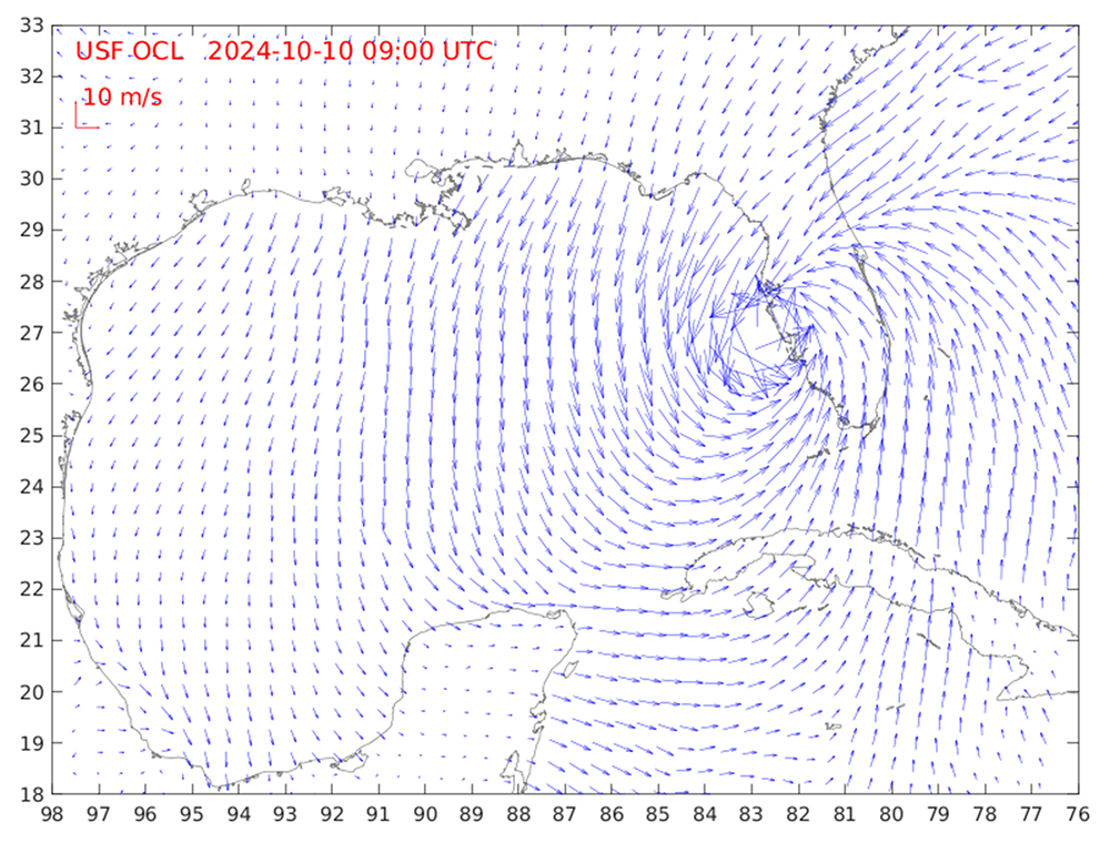
IMAGE ABOVE: This image from the Forecast Winds in the Gulf of Mexico Region (NOAA/NCEP NAM Product) depicts wind fields in the Gulf of Mexico region as Hurricane Milton made landfall in Florida. Courtesy of Yonggang Liu.
Yonggang Liu, associate professor and director of OCL, said data from the buoys forecasted a rapid intensification was likely.
“Our buoy data showed high subsurface water temperatures before hurricanes Helene and Milton, which are necessary for rapid intensification,” Liu said.
The ocean’s subsurface temperature is a strong indicator of the fuel available for storms. Prior to Helene, OCL’s real-time sensors recorded water temperatures four degrees Celsius warmer than the 26-degree Celsius threshold needed for hurricanes to develop. Even after evaporation caused by Hurricane Helene decreased the temperature of the water by a few degrees, the Gulf retained enough heat to drive intensification.
Recognizing the need for timely and accurate predictions of likely consequences from storms, OCL developed and launched a visualization tool that integrates numerical models with data recorded by tide gauges to forecast the potential impact of hurricanes, specifically the magnitude of storm surge.
“Our guidance offers a one-day hindcast and a three-day prediction of coastal water levels that provides advance warning of storm surge,” said Liu. The OCL updated on the information on their public website multiple times a day during hurricanes Helene and Milton. OCL postdoctoral researchers Haibo Xu and Kaili Qiao contributed to the development and updating of the guidance.
VIDEO ABOVE: Storm surge forecast for Hurricane Helene, just before the storm made landfall. Courtesy of Yonggang Liu.
This product was a collaboration between OCL and the Florida Flood Hub.
“The Florida Flood Hub is pleased to partner with the OCL to further develop and advance models that can accurately forecast storm surge along Florida’s Gulf coast,” said Tom Frazer, dean of the College of Marine Science and executive director of the Florida Flood Hub. “These models can provide near real time forecasts and serve as essential tools to aid pre-storm decisions by emergency managers.”
“We’ve been working on this model for many years,” said Liu. “I am happy that it brought added value by accurately predicting these surge events in the Tampa Bay region.”
Liu stressed that long-term observations are critical to providing accurate information.
“The more data you have to prepare the initial condition of model, the more accurate the forecast will be and the better prepared Floridians can be for the next storm,” he said.
