By: Dyllan Furness, Science Communication Manager for the Florida Flood Hub for Applied Research and Innovation
There’s never a dull moment in the Ocean Circulation Lab at the USF College of Marine Science. Surface buoys need maintenance. Bottom mounts equipped with ocean monitoring instruments need to be recovered from the seafloor.
When hurricane season rolls around, busy gets a new meaning for the lab, which operates several high-resolution models that forecast currents and water levels along the western coast of Florida.
“Hurricane season can be a very demanding time of year for us,” says Yonggang Liu, associate research professor and director of the Ocean Circulation Lab (OCL). “Our lab has been quick to respond to tropical storms in the past to make sure we can provide the most reliable data possible to people who need them most.”
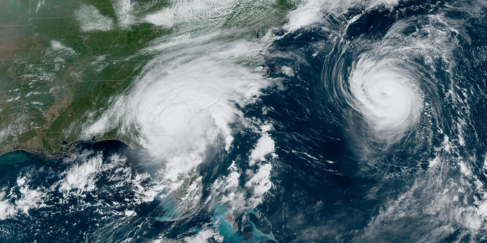
Above-average ocean temperatures and the influence of La Niña have put Liu and his team on high alert going into the 2024 Atlantic hurricane season. The National Oceanic and Atmospheric Administration (NOAA) predicts 17 to 25 named storms and four to seven major hurricanes (Category 3 and higher).
While hurricanes are categorized by wind speed, water is what often gives them their deadly power.
Storm surge — the sudden rise in water level typically associated with low-pressure weather systems — has been shown to account for nearly half of all fatalities from tropical storms.
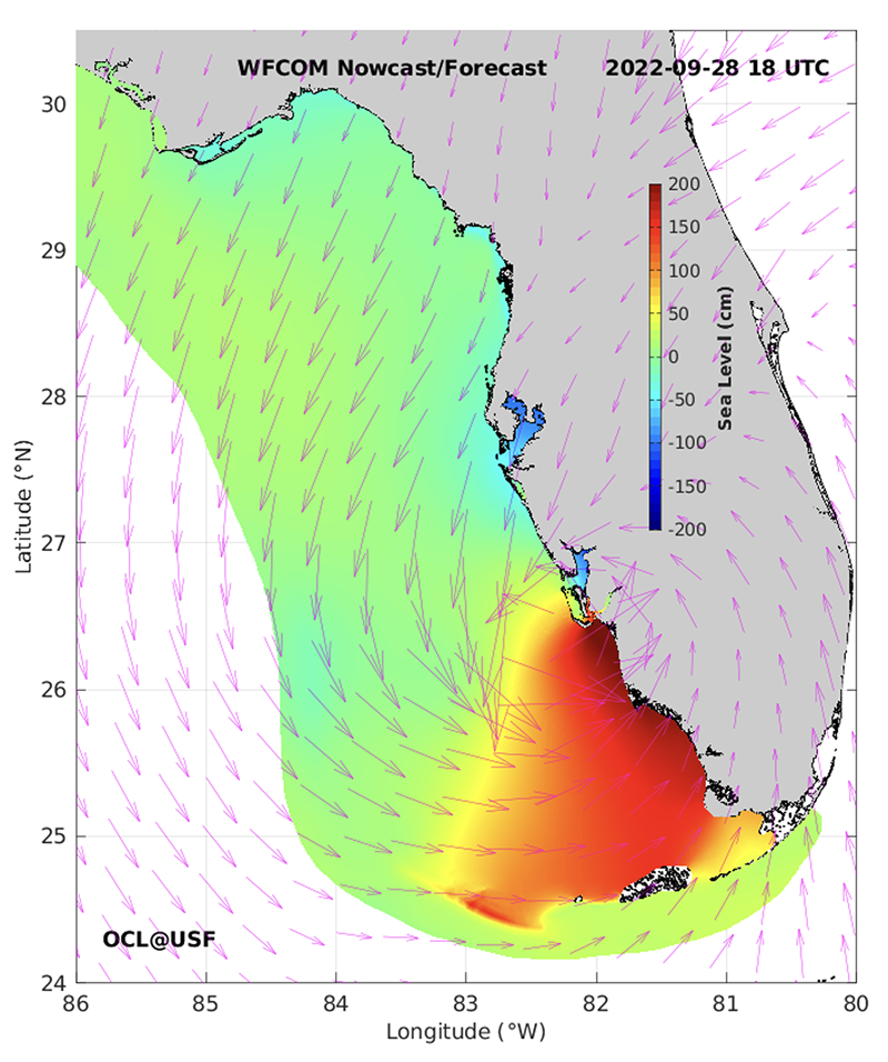
IMAGE ABOVE: This static visualization of the West Florida Coastal Ocean Model shows dramatic changes in sea level along Florida’s southwest coast during Hurricane Ian in September 2022. Credit: Ocean Circulation Lab at the USF College of Marine Science.
OCL researchers are hard at work improving storm surge forecasting capabilities along the west coast of Florida. First developed by the lab more than a decade ago, the West Florida Coastal Ocean Model (WFCOM) and Tampa Bay Coastal Ocean Model (TBCOM) can now be used to forecast water levels days before hurricane landfall.
“Our models are unique in that they are high-resolution and fully three-dimensional, even for shallow water regions,” says Liu. “Realistic simulation of coastal ocean circulation is key for forecasting storm surge, which can be so devastating for coastal communities.”
As Category 5 Hurricane Ian approached Florida in September 2022, Liu monitored the models from his home in St. Petersburg. While TBCOM predicted that the storm would push water out of Tampa Bay, WFCOM, which covers the larger coastal region of the northeastern Gulf of Mexico, predicted significant storm surge in Lee and Collier counties. Buoy and tide-gauge data later validated both predictions.
Liu had the opportunity to test the models again a year later when Hurricane Idalia began to brew in the Gulf of Mexico. As the Category 4 storm buzzed along the west coast of Florida, TBCOM and WFCOM accurately predicted storm surge of about 1.5 meters in Tampa Bay and about 2 meters at Cedar Key.
VIDEO ABOVE: This visualization of the West Florida Coastal Ocean Model shows forecasted storm surge along western Florida during Hurricane Idalia in August 2023. Credit: Ocean Circulation Lab at the USF College of Marine Science.
A recent partnership with the Florida Flood Hub for Applied Research and Innovation further strengthens OCL’s capability in storm surge forecasting. A new version of WFCOM used for daily nowcasts/forecasts will not only have improved resolution and coverage for intracoastal waterways and small estuaries but will also run more efficiently and reliably thanks to a source code update, Liu says.
Based on the circulation nowcast/forecast systems, two new products will be developed in partnership with the Flood Hub for storm surge forecasts along Florida’s west coast.
The first is the WFCOM-based coastal water level veracity testing and forecast guidance product, which combines model output with near-real-time tide gauge observations. The other is a TBCOM-based flooding and inundation forecast system that focuses on the Tampa Bay area.
Better visualization products of storm surge forecasts will also be developed collaboratively between OCL and the Flood Hub and will be made available to the public through the Flood Hub’s website.
“The Ocean Circulation Lab has long been a leader in circulation modeling,” says Tom Frazer, dean of CMS and executive director of the Flood Hub. “We’re excited to partner with the lab, leverage its products and expertise, and help Floridians better prepare for flooding events.”
Also new this hurricane season, Liu’s team will start real-time delivery of subsurface temperature measurements using instruments affixed to mooring buoys in the Gulf of Mexico. Over 20 years of subsurface temperature records will help the research track temperature anomalies. The data will be made available to NOAA for its hurricane forecasting.
VIDEO ABOVE: The Ocean Circulation Laboratory maintains a series of moorings on the West Florida Shelf that provide real-time observations of surface meteorology and water column physical properties, such as velocity, temperature, and salinity. Credit: Ocean Circulation Lab at the USF College of Marine Science.
“Subsurface temperature is an important factor in hurricane intensification,” Liu says. “That’s particularly relevant along the west coast of Florida, where relatively shallow waters mean there’s less cool, deep water to mix with the warm water while a storm passes over. Heating from warm water can fuel a storm rapidly as seen from the Hurricane Ian event.”
Prior to Ian’s landfall in 2022, surface temperatures in the Gulf of Mexico were about one degree warmer than climatology, Liu says, but subsurface temperatures were two to three degrees warmer than climatology.
“That meant there was a lot of heat content on the shallow West Florida Shelf,” he says. “We hope our temperature measurements will help the forecasters at the National Hurricane Center improve their tropical storm forecasts.”
OCL was launched in 1984 by Distinguished University Professor Emeritus Robert Weisberg and has since established itself as a leader in circulation observing and modeling.
"Our lab has been maintaining the coordinated observing and modeling program for many years,” Liu says. “The accuracy we see in these models today is the product of sustained effort from Dr. Weisberg and other scientists in the Ocean Circulation Lab. In terms of coastal implications for our region, you won’t find anything better than these models.”