By: Dyllan Furness, Director of Communications
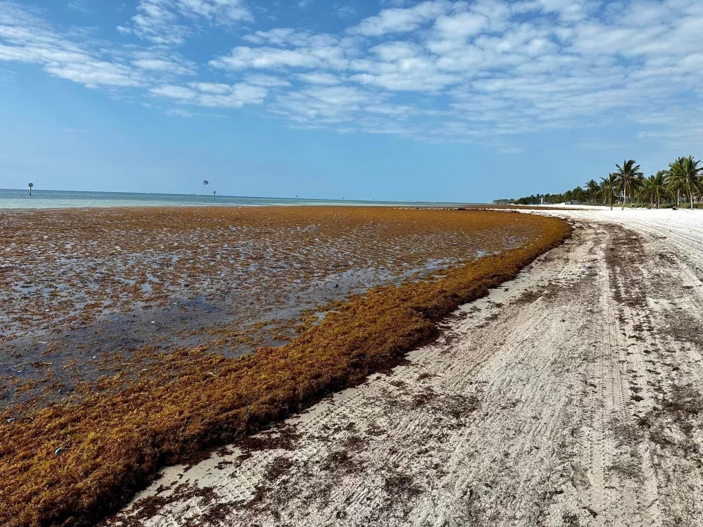
A yellow-brown seaweed called Sargassum has become an annual problem for communities across Florida, the Caribbean, and Gulf Coast.
Since 2011, large mats of Sargassum wash ashore each spring and summer. Where they decay, they emit a foul rotting odor, harm marine life, and disrupt local communities. Annual economic impacts to U.S. businesses and governments are reaching millions of dollars due to costly removal and cleanup efforts, as well as disruptions to fisheries and tourism. In 2022, a massive influx of Sargassum at a desalination plant on St. Croix triggered a regional emergency response effort to safeguard the island's primary water source.
Resource managers in South Florida now have a new tool in their fight against Sargassum thanks to a five-year, $3.2-million grant from the National Oceanic and Atmospheric Administration (NOAA) Monitoring and Event Response for Harmful Algal Blooms program that was awarded in 2023.
The project, which is led by the USF College of Marine Science (CMS), is allowing researchers to develop a high-resolution detection and forecasting system for areas of South Florida, which will soon be expanded to include coastlines across Florida and the Caribbean. The new tool builds on the Sargassum Watch System from the Optical Oceanography Lab at CMS, and will be featured in the lab’s upcoming Sargassum outlook bulletin.
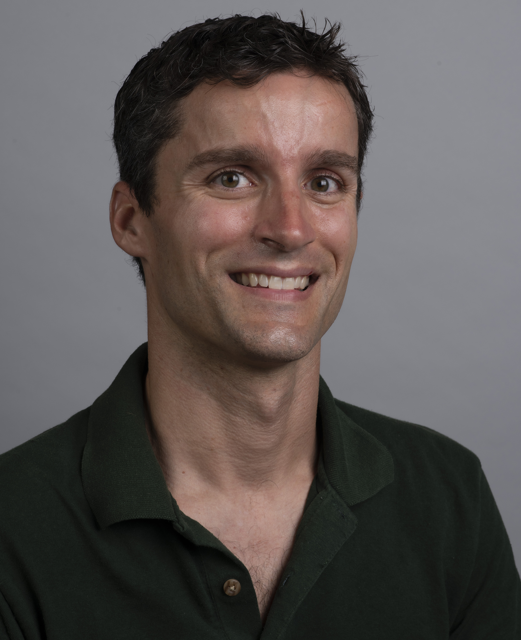
IMAGE ABOVE: Brian Barnes, the project’s principal investigator, is an assistant research professor in the USF College of Marine Science’s Optical Oceanography Lab.
“While our Sargassum Watch System has been a useful tool for people across Florida and the Caribbean, our updated system has vastly improved capabilities,” said Brian Barnes, assistant research professor at CMS and the project’s principal investigator. “The new system relies on satellites that provide data at a scale of about 50 meters (about half the area of a football field), as compared to several kilometers in our current system. Thus, instead of looking at Sargassum inundation risk at the scale of the Florida Keys region, we are now able to see potential impacts at an individual beach scale.”
High-resolution satellite data are now available for the Middle/Upper Florida Keys and Lower Keys regions, with broader coverage scheduled to be online in the coming weeks. Small slicks of Sargassum, which were previously not detectable, are now clearly visible in the updated imagery. In the example below, detected Sargassum is shown for two dates, with the current course-resolution product on the left, and the new products shown on the right.
Another big step in the system includes algorithms that will allow researchers to forecast the movement of the Sargassum several days in advance.
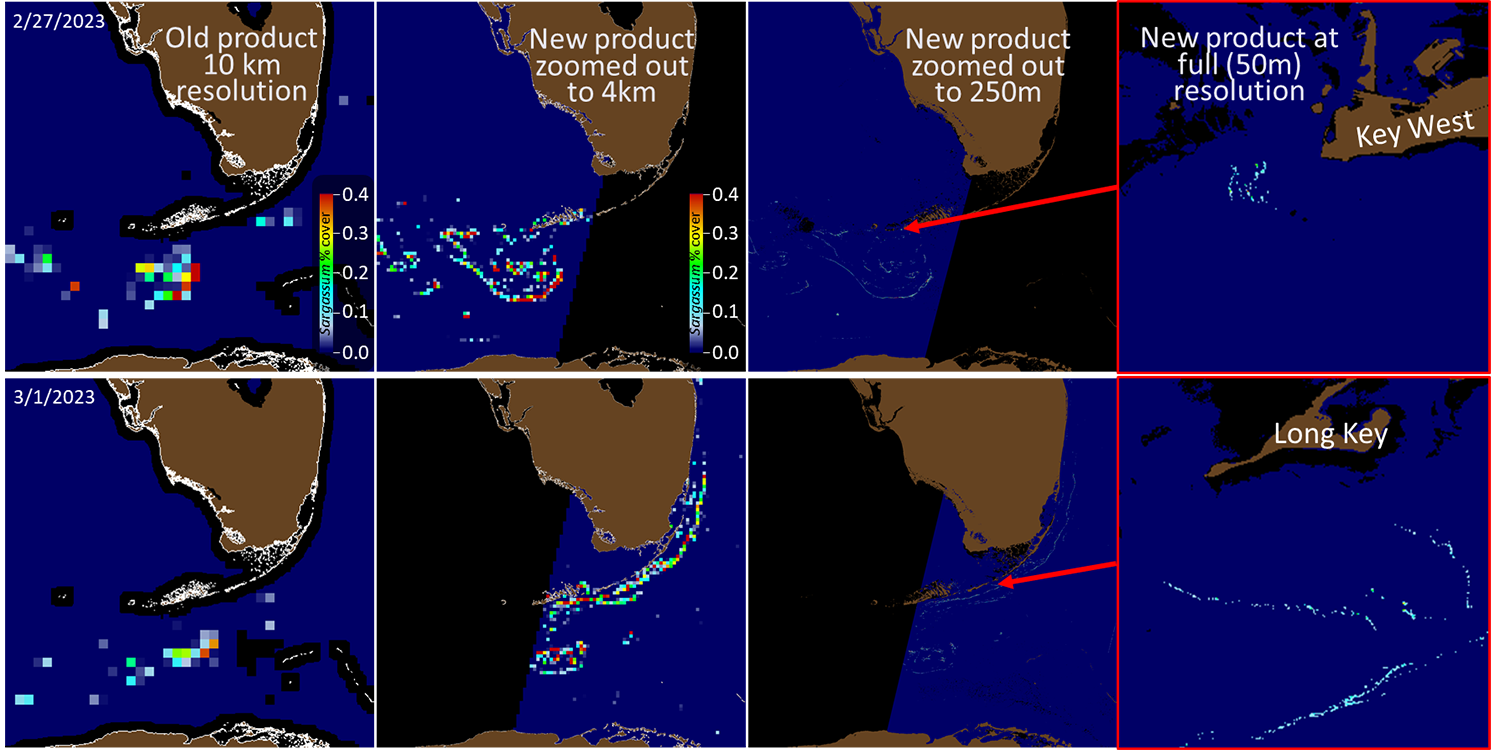
The figure above depicts the improved resolution of the Sargassum watch system. Courtesy of Brian Barnes.
The Sargassum forecasting component of the project capitalizes on a long-standing partnership between Yonggang Liu, associate professor and director of the Ocean Circulation Lab at CMS, and researchers at the Caribbean Coastal Ocean Observing System (CariCOOS). For this project, they will combine the higher-resolution satellite images with coastal ocean circulation models. CariCOOS recently launched an inundation forecast for Puerto Rico and the U.S. Virgin Islands based on coarse resolution data and forecast trajectories.
“These models, which have been refined in our lab, will allow us to determine where the algae will end up over the next few days,” Liu said. “We hope this will give tremendous value to people on the ground managing Sargassum inundations.”
The ability to predict where Sargassum will come ashore is a crucial step in management. Sargassum is considered essential wildlife habitat when it’s offshore but becomes problematic when it reaches coastlines. When Sargassum decays, it depletes oxygen, releases harmful gases, and can cause fish kills.
For people like Shelly Krueger, extension agent with Florida Sea Grant in Monroe County, new tools for monitoring and forecasting Sargassum will help her convey key messages to local stakeholders. Although her region has been spared from a major inundation since 2018, the tools will help professionals respond in the event that patches of Sargassum wash ashore.
“These tools will help me educate people about ocean patterns as they relate to Sargassum,” Krueger said. “They will also allow our resource managers in Monroe County to be proactive. When the arrival of a patch of Sargassum is imminent, they can put up barriers, close impacted canals and marinas, and plan for increased mechanical removal to address the inundation as soon as it happens.”
“In just one year, this NOAA-funded partnership has helped drive innovations in satellite detection and predictive modeling that have improved Sargassum tracking and early warning products,” says Marc Suddleson, NOAA MERHAB program manager. “Additional advances over the next four years will result in more accurate predictions of timing and location of Sargassum inundation along U.S. coastlines, giving officials across Florida, Puerto Rico and the U.S. Virgin Islands more time to plan for — and minimize the impacts of — these events.”
The University of South Florida partners with Florida Atlantic University, Caribbean Coastal Ocean Observing System, U.S. Virgin Islands Department of Planning and Natural Resources, and NOAA Atlantic Oceanographic and Meteorological Laboratory on this NOAA MERHAB funded project.