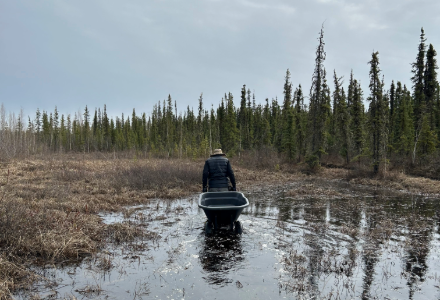
Timothy Dixon ferrying state-of-the-art equipment transporter to the equipment assembly point.
A research initiative, funded by NASA and the Army Corps of Engineers, is underway to study permafrost thaw in Alaska and its significant impacts on the environment. This project aims to understand the landforms created by thawing permafrost, how it affects methane emissions and whether the rate of permafrost thaw is accelerating.
Leading this research is Timothy Dixon, a professor in the School of Geosciences. Research effort includes USF graduate students Robert Van Alphen and Taha Sadeghi Chorsi, as well as post-doc Jason Shabaga and his advisor Merritt Turetsky at the University of Colorado, Boulder. While remote sensing data has revealed that Earth's major ice reservoirs—such as sea ice, glaciers, and the ice sheets of Greenland and Antarctica—are losing ice mass at an accelerating rate, the fate of permafrost remains uncertain. This uncertainty arises because permafrost is typically obscured by a thick layer of vegetation, making it challenging to monitor from space.
Permafrost is a big interest in climate modeling due to its potential to release large quantities of methane, a potent greenhouse gas. This release could create a positive feedback in climate change: a small amount of warming could release methane, accelerating warming and causing more permafrost thaw and methane release.
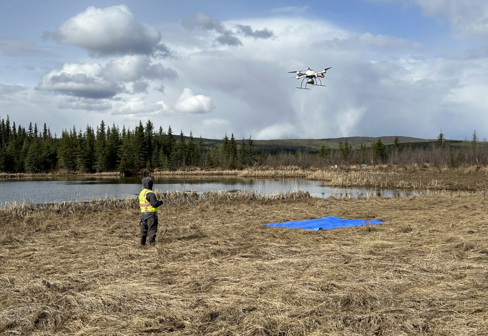
The research team is utilizing two types of sensors, lidar and radar, to gather data. One of the key sites for this research is Big Trail Lake, a thermokarst lake and a well-studied methane emitter.
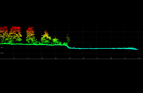
The image on the right shows lidar data collected at Big Trail Lake. The team is investigating whether drone-mounted lidar can track the geomorphic changes associated with the lake's expansion as the underlying permafrost melts. This method could provide crucial information on future methane emissions. The team plans to return in August to see if the profile changes as the underground ice melts, causing the land to subside—an effect they hope to measure with their lidar technology.
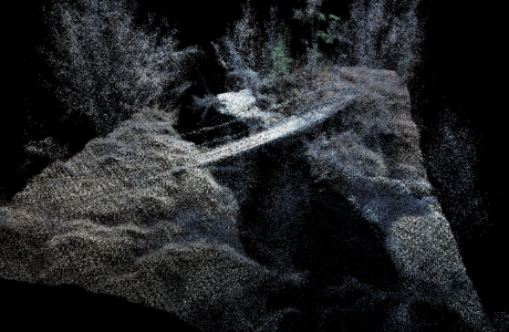
The figure on the left presents a 3D perspective view of a small stream covered by a wood and rope bridge. In this image, the white "blob" behind the bridge represents permafrost ice protruding from the stream bank. The rope, about 1 cm in diameter, gives a sense of the lidar's spatial resolution.
This research is critical for improving our understanding of permafrost dynamics and their broader implications for climate change. By integrating advanced sensing technologies and field studies, the team aims to shed light on the intricate processes governing permafrost thaw and its environmental impacts.